The summer drone tour of seagrass restoration sites across North-West Europe marked an important milestone for the REBORN project. Beginning in Ireland and continuing through France, the Netherlands, and Germany, the tour allowed the Nantes University team to come together with each site coordinator and local drone pilots. The purpose of this trip was to develop and implement a consistent and reproducible method for monitoring intertidal seagrass restoration across the four participating countries.
The main objective was to establish a high-resolution drone imagery baseline that would allow researchers to monitor the restoration and development of Zostera noltii meadows over time. Also known as dwarf eelgrass, Zostera noltii is an important intertidal seagrass species. Its meadows provide habitats for marine organisms, stabilise sediments, support coastal biodiversity, and contribute to the overall health and resilience of coastal ecosystems.
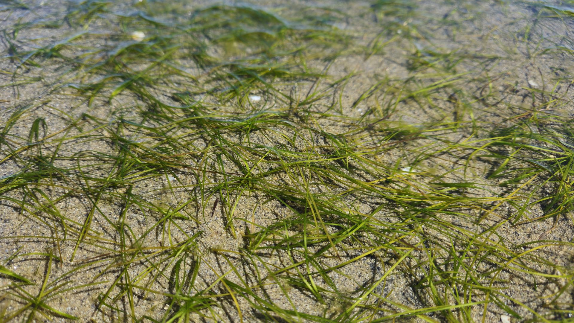 The Zostera noltii meadow in Killala
Bay is characterised by a short, narrow-leaved morphotype.
The Zostera noltii meadow in Killala
Bay is characterised by a short, narrow-leaved morphotype.
To ensure that data collected in the different countries could be compared, the Nantes University team - Philippe Rosa, Simon Oiry, Pierre Gernez and Laurent Barillé - developed a standardised drone-mapping methodology. This involved working alongside local drone pilots, sharing detailed protocols, and ensuring that the same flight plans could be repeated consistently throughout the monitoring period. Such standardisation was essential to prevent differences in flight altitude, camera settings, image overlap, or flight paths, all of which could have made comparisons between the restoration sites more difficult.
Killala Bay, Ireland
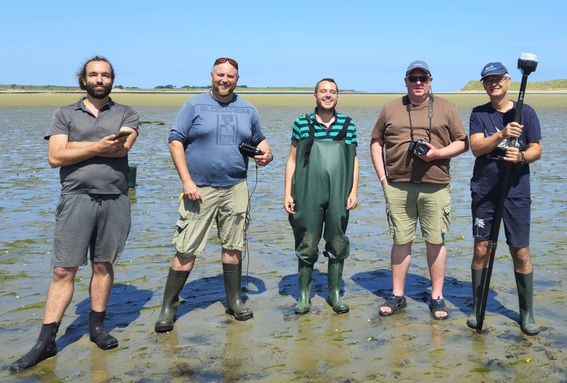 Sharing drone monitoring practices in Killala
Bay, Ireland, with our colleagues from the Ryan Institute. From left: Simon
Oiry, Dave O’Leary, Juan Lugilde Yáñez, Liam Morrison, and Laurent Barillé.
Sharing drone monitoring practices in Killala
Bay, Ireland, with our colleagues from the Ryan Institute. From left: Simon
Oiry, Dave O’Leary, Juan Lugilde Yáñez, Liam Morrison, and Laurent Barillé.
The first stop was Killala Bay on the North-West coast of Ireland, where the team worked with colleagues from the University of Galway’s Ryan Institute, including Juan Lugilde Yáñez and Liam Morrison. The visit to Killala Bay included experimental transplanted seagrass plots, while the Moy estuary was the donor site that we visited on the second day.
During the visit, the team worked with and trained drone pilot Dave O’Leary, who operated the same DJI Mavic 3 Enterprise RGB drone as the Nantes University team. Dave already had considerable experience in drone-based gamma radiation monitoring. After one day of training in the REBORN monitoring methodology, he was fully prepared to conduct monthly surveys of both the donor and restored seagrass sites.
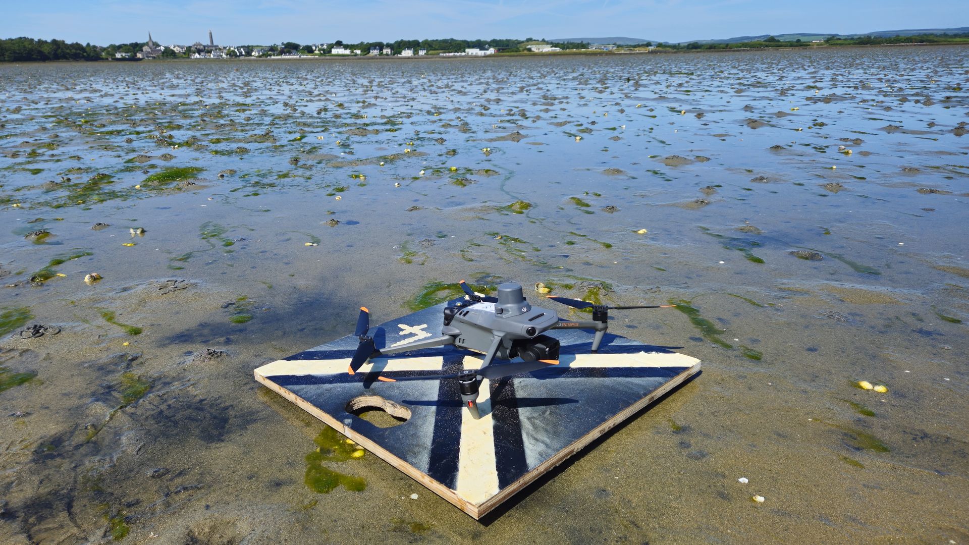 The Mavic 3E, piloted by Dave O’Leary in Killala
Bay, Ireland, has been programmed with flight plans and points of interest for
monthly monitoring of the Zostera noltii restoration sites.
The Mavic 3E, piloted by Dave O’Leary in Killala
Bay, Ireland, has been programmed with flight plans and points of interest for
monthly monitoring of the Zostera noltii restoration sites.
The standard monitoring flights were conducted at an altitude of 12 metres and produced images with a ground resolution of approximately three millimetres, allowing the identification of seasonal developments in the meadows through changes in vegetation cover. For the smallest restoration plots, the team tested an even more detailed monitoring method. An automated waypoint mission was designed in which the drone flew at an altitude of five metres before descending to only two metres above the seagrass. This approach functioned as a virtual photographic quadrat and captured ultra-high-resolution images without requiring researchers to enter and potentially disturb the restored plots.
The flight plan was also optimised using a custom Python script. The resulting images were sufficiently detailed to reveal features such as epiphyte cover on individual seagrass leaves.
Arcachon Bay, France
The second site was Arcachon Bay, near Audenge on the French Atlantic coast. It is one of REBORN’s two lighthouse sites. The mission was conducted in collaboration with the Office français de la biodiversité, or French Biodiversity Agency, and drone pilot Romuald Chaigneau.
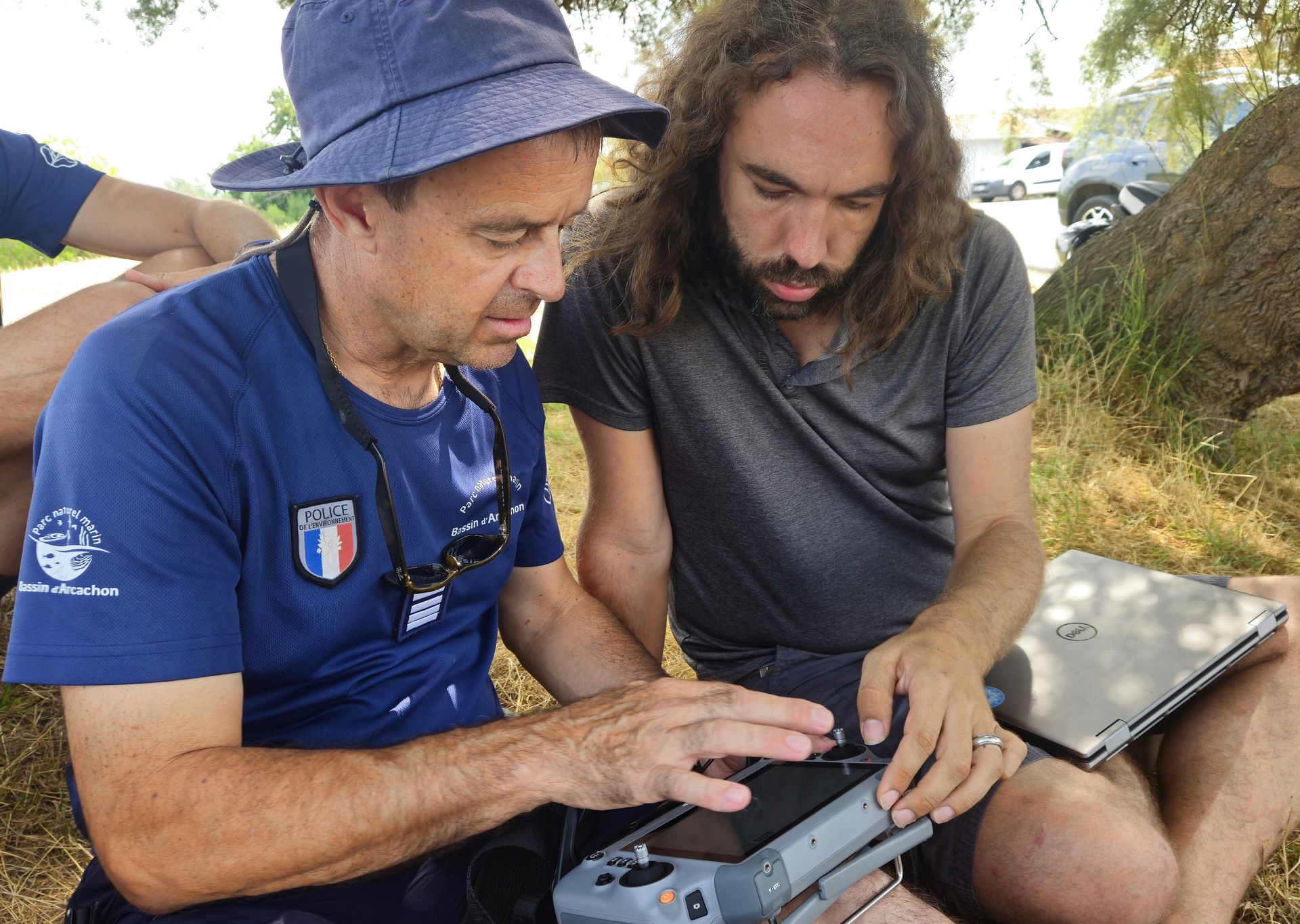 The Office français de la biodiversité (OFB), or
French Biodiversity Agency drone pilot Romuald Chaigneau is trained by Simon
Oiry from Nantes University to fly his Matrice 4 over the Zostera noltii
restoration sites in Audenge, Arcachon Bay.
The Office français de la biodiversité (OFB), or
French Biodiversity Agency drone pilot Romuald Chaigneau is trained by Simon
Oiry from Nantes University to fly his Matrice 4 over the Zostera noltii
restoration sites in Audenge, Arcachon Bay.
Arcachon Bay is one of the flagship locations of the REBORN project. It supports one of Europe’s largest intertidal meadows of Zostera noltii and benefits from valuable local experience in seagrass conservation and restoration. The bay is also an important centre for oyster farming and shellfish production. Seagrass restoration in this environment therefore must consider both ecological objectives and existing human activities.
Romuald operated a DJI Matrice 4 drone, a more recent platform than the DJI Mavic 3 Enterprise used by the Nantes University team. However, both drones used the same DJI Pilot 2 software, which allowed the standardised flight plans to be transferred and repeated without difficulty.
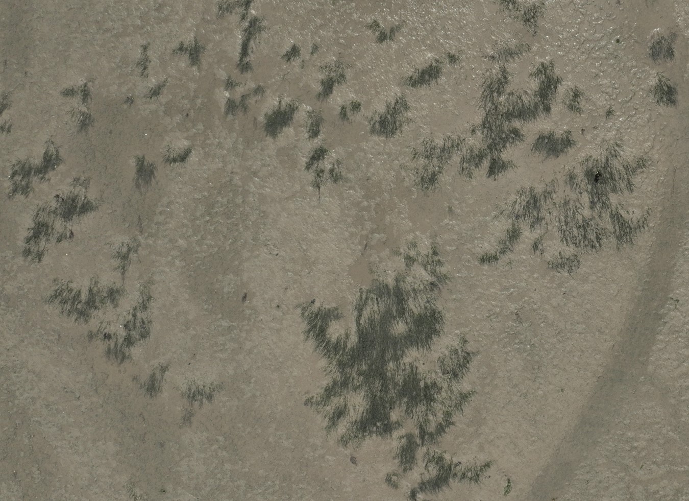 A zenithal view of a Zostera noltii meadow in
Audenge, Arcachon Bay, captured by a Mavic 4 RGB drone at an altitude of 12 m.
A zenithal view of a Zostera noltii meadow in
Audenge, Arcachon Bay, captured by a Mavic 4 RGB drone at an altitude of 12 m.
The monitoring method combined systematic flights at an altitude of 12 metres with lower-altitude surveys of selected points of interest. This dual approach provided complete coverage of the restoration areas while also producing extremely detailed imagery of individual plots. Following the training and fieldwork, Romuald was ready to collect monthly monitoring data using the shared methodology. We also conducted LiDAR surveys at two complementary altitudes: a 60-metre flight to capture the overall topography of the restored area, and a 12-metre flight over a small transplanted zone to obtain very-high-resolution topographic data.
The successful mission in Arcachon Bay was also supported by Florine Verhaeghe and Thomas Fauvel, whose assistance and local knowledge contributed greatly to the work.
Oosterschelde, the Netherlands
The third stop on the tour was the Oosterschelde, or Eastern Scheldt Estuary, in the Netherlands, which was the second lighthouse site of the REBORN project. There, drone surveys supported an ongoing Zostera noltii restoration experiment coordinated by Prof. Laura Govers from the University of Groningen, the lead coordinator of REBORN.
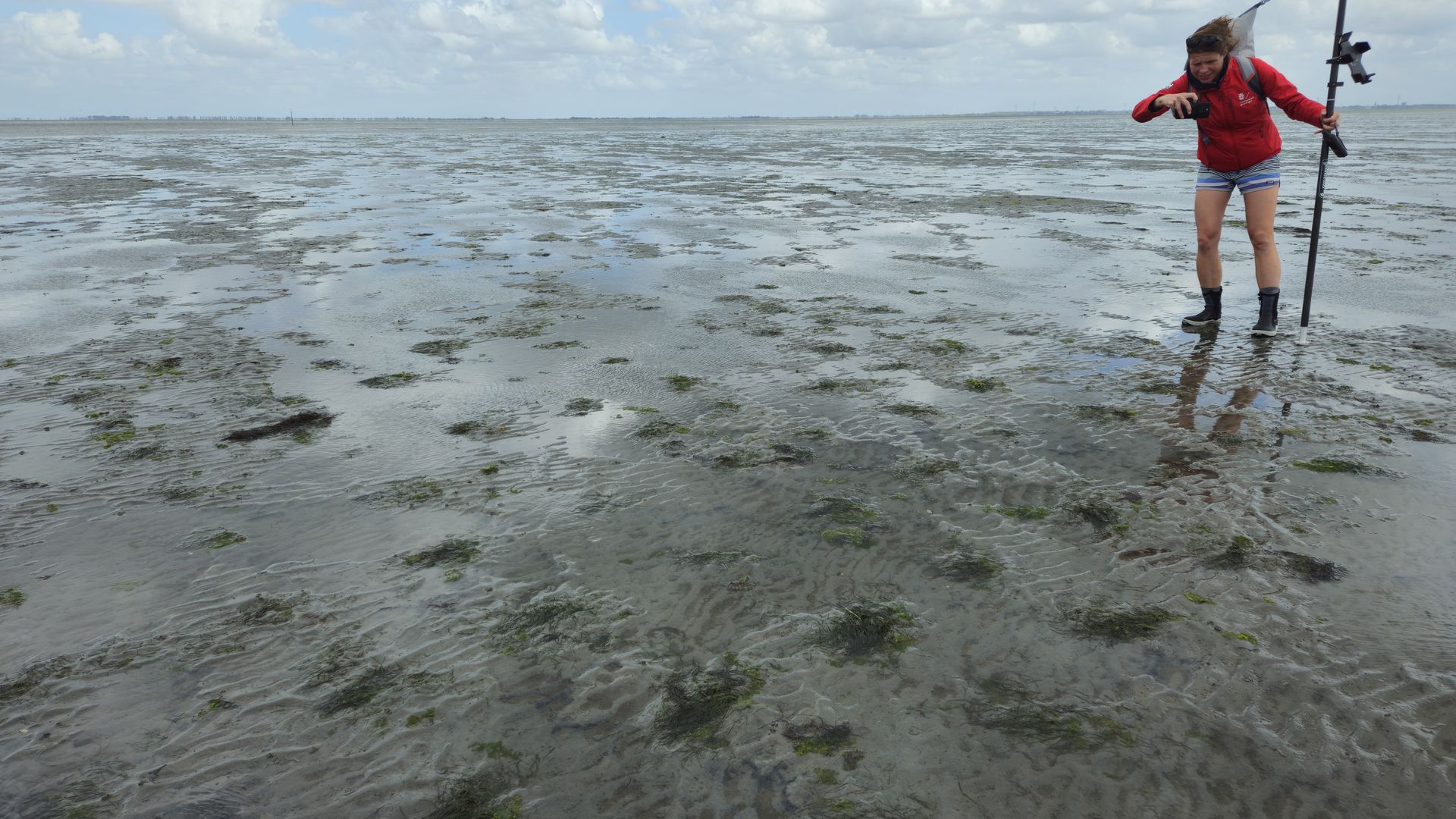 Prof. Laura Govers of the University of
Groningen inspects Zostera noltii restoration plots
in the Oosterschelde, the Netherlands.
Prof. Laura Govers of the University of
Groningen inspects Zostera noltii restoration plots
in the Oosterschelde, the Netherlands.
Restoring seagrass in this dynamic intertidal environment is demanding and time-consuming work. The transplanted plants must withstand strong tidal currents, sediment movement, changing water conditions, and other environmental pressures. Very high-resolution drone imagery could provide an efficient and non-invasive method for monitoring the survival and fine-scale expansion of the restored plots. During the visit, the team observed encouraging results across the restoration experiments.
Laura operated the same DJI Mavic 3 Enterprise RGB drone as the Nantes University team, which made it straightforward to transfer and implement the standardised monitoring protocol. Eight flight plans were carried out, covering eight experimental polygons in which different restoration techniques had been tested. For two of these polygons, additional automated waypoint flights were conducted, with photographs captured at an altitude of only two metres. These low-altitude surveys produced ultra-high-resolution imagery of the restored seagrass while avoiding physical disturbance of the experimental plots.
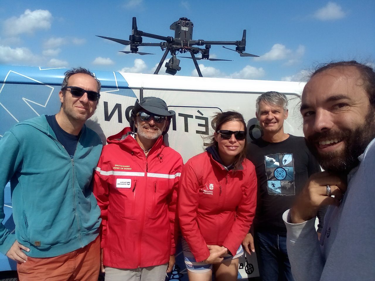 Despite strong winds of
up to 35 km/h, the team successfully completed all planned drone flights in the
Oosterschelde, the Netherlands. From left: Pierre Gernez, Philippe Rosa, Laura
Govers, Laurent Barillé, and Simon Oiry.
Despite strong winds of
up to 35 km/h, the team successfully completed all planned drone flights in the
Oosterschelde, the Netherlands. From left: Pierre Gernez, Philippe Rosa, Laura
Govers, Laurent Barillé, and Simon Oiry.
Finally, the entire area was surveyed using LiDAR. The resulting data provided a detailed topographic model of the restored intertidal flat, enabling future analyses of how fine-scale variations in elevation and surface morphology influence seagrass establishment and development.
German Wadden Sea, Lower Saxony
The final stop was the German Wadden Sea in Lower Saxony, where the team worked with Sylvia Zaun and Johanna Behrisch from the Lower Saxon Department for Water, Coastal and Nature Conservation, or NLWKN.
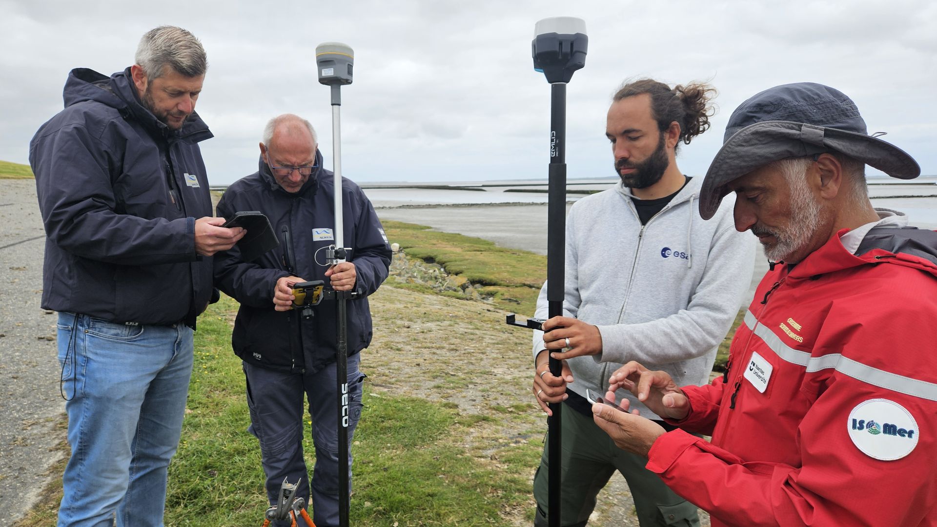 Exchanging dGPS positioning methods and
drone-surveying practices between the Lower Saxony Water Management, Coastal
Defense and Nature Conservation Agency (NLWKN) and Nantes University. From
left: Gerd Rosendahl, Folkert Diepen, Simon Oiry, and Philippe Rosa.
Exchanging dGPS positioning methods and
drone-surveying practices between the Lower Saxony Water Management, Coastal
Defense and Nature Conservation Agency (NLWKN) and Nantes University. From
left: Gerd Rosendahl, Folkert Diepen, Simon Oiry, and Philippe Rosa.
Unlike the other three sites, seagrass restoration activities have not yet begun in Lower Saxony. The objective of this mission was therefore to map the existing distribution of intertidal seagrass and identify areas that could be suitable for future restoration. The surveys focused on Jade Bay near Tossens and Burhave, as well as the coastal area between Bensersiel and the East Frisian island of Langeoog.
Mapping seagrass in this region was particularly challenging as the patches were often small, scattered, and characterised by low vegetation density. They were also located close to highly concentrated biofilms of benthic microalgae. At the ten-metre spatial resolution of Sentinel-2 satellite imagery, signals from seagrass and microalgae were frequently mixed, preventing accurate classification in some areas.
Using a drone-mounted MicaSense multispectral camera, the team collected data at a spatial resolution of approximately eight centimetres. This made it possible to distinguish different forms of intertidal vegetation and accurately map small patches of Zostera noltii. High-resolution LiDAR data were also collected to investigate how subtle variations in mudflat topography influenced seagrass distribution and density.
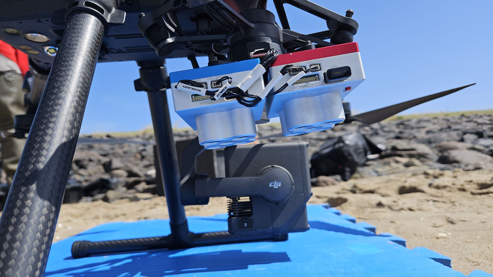 Detail of the multispectral camera (MicaSense
Dual sensor) and Zenmuse L1 LiDAR system deployed over the German Wadden Sea intertidal
flats to identify the most suitable locations for seagrass restoration in Lower
Saxony.
Detail of the multispectral camera (MicaSense
Dual sensor) and Zenmuse L1 LiDAR system deployed over the German Wadden Sea intertidal
flats to identify the most suitable locations for seagrass restoration in Lower
Saxony.
Together, the surveys conducted at Killala Bay, Arcachon Bay, the Oosterschelde and the German Wadden Sea established the foundations of a shared European monitoring framework. By combining standardised drone flights, advanced imaging technology and local expertise, the REBORN project generated valuable information for assessing restoration success and identifying suitable locations for future seagrass recovery.